LAND SURVEYING
Land surveying is the process of accurately measuring and mapping the physical features of a piece of land, including its boundaries, contours, and elevations.
It is an essential component of many construction and development projects, as well as legal and property transactions. Surveyors use a variety of tools and techniques, including GPS, laser scanning, and traditional instruments like theodolites and levels, to gather and analyze data about land and its characteristics.
-
Lot subdivision surveying is the process of dividing a larger piece of land into smaller lots for development or sale. It involves determining the boundaries and dimensions of each lot, as well as identifying any easements, rights-of-way, or other legal considerations that may affect the subdivision. Lot subdivision surveys are typically required by local planning and zoning agencies, and must adhere to strict regulations and standards to ensure that the subdivision is safe and compliant with local laws.
-
Water right surveying is the process of determining and documenting the legal rights to use and access water resources, such as rivers, lakes, and groundwater. It involves identifying and mapping the physical boundaries of water sources, as well as the legal and administrative frameworks that govern their use. Water right surveying is essential for managing water resources sustainably and ensuring that water is allocated fairly and efficiently among different users and stakeholders.
-
A topographical survey is a type of land survey that measures and maps the shape, features, and contours of a piece of land. It provides detailed information about the land's natural and man-made features, such as hills, valleys, rivers, buildings, and roads. Topographical surveys are used in a wide range of applications, from planning and design to construction and environmental management.
-
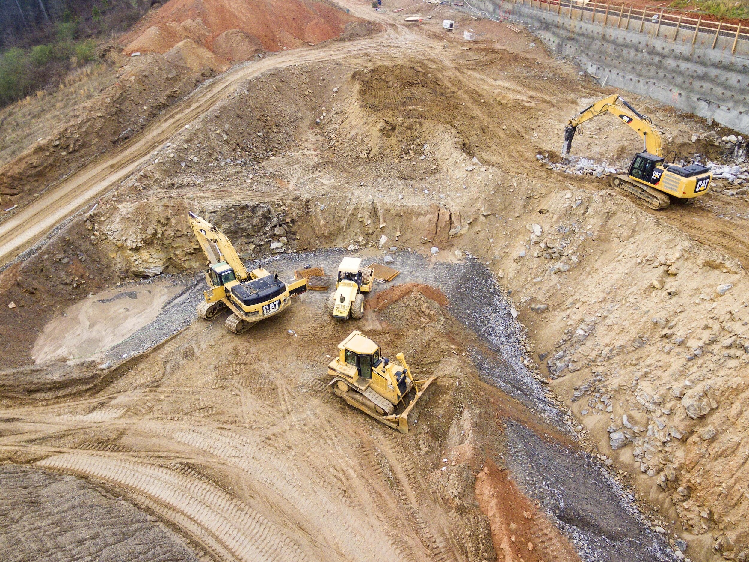
UAV (unmanned aerial vehicle) surveying, or Drone Mapping, is a technique that uses drones to gather data about land and infrastructure. It has revolutionized the field of surveying by allowing for more efficient and accurate data collection, particularly in hard-to-reach or hazardous areas. UAV surveying can provide high-resolution aerial images, 3D maps, and other types of data that can be used for a variety of applications, from construction planning to environmental monitoring.
-
ALTA surveying (American Land Title Association) is a type of land survey that is often required for commercial real estate transactions. It is a comprehensive survey that includes detailed information about property boundaries, easements, encroachments, and other factors that may impact the ownership or development of the land. ALTA surveys are typically performed by licensed surveyors and must adhere to strict standards set forth by the ALTA and the National Society of Professional Surveyors.
-
GIS surveying (Geographic Information System) is a method of surveying that uses specialized software to capture, store, manipulate, analyze, and display geospatial data. It allows surveyors to create detailed maps and models that incorporate a wide range of data, from satellite imagery and topographical data to social and economic indicators. GIS surveying is used in a variety of fields, including urban planning, environmental management, and natural resource management, to help make informed decisions and solve complex problems.